Wednesday 9 May 2012

Exmoor Coastal Trail Ultra Marathon 2012

Intro


The Exmoor Ultra is probably the toughest and most visually stunning of the CTS courses.  The combination of high exposed coastal path combined with quiet wooded valleys provides some beautiful scenery with really challenging descents and ascents.


This description has been taken from the Endurance Life website


"The Exmoor National Park is one of England's best kept secrets, ............ The course encompasses stiff climbs and long descents, open moorland, thickly wooded combes (valleys), historical ruins, dizzying cliffs, exquisitly beautiful rivers and a stretch of coastline that is unsurpassed. ........... there is no course in Britain that offers such a variety of terrain within such a compact area. This truly is trail running territory at its best.

The Exmoor course is widely regarded as the toughest course in The Series and is definitely a grueling test of endurance for even the very hardest of trail and fell runners"

I entered the Devon and Exmoor Ultras as preparation for the four long distance triathlons I'm doing later in the year - Celtman Tri, X-Man off-road Tri, Norseman Tri and the Devon C2C extreme.  I figured trying to complete a 54k trail run with 1500m-ish of ascent would take me to some 'fairly dark places', but hopefully give me the confidence to push through similar and inevitable 'difficult' periods of the triathlon run leg.


Route Map.  Picture provided courtesy of Endurance Life.

The Ultra follows the marathon route plus an addition lap of the 10k route.  Image courtesy of Google maps.


Ultra route elevation.  Over the 54k the total ascent is 1981m (Ben Nevis is 1344m high)


Pre Race - Friday
On friday I had the usual meal of low GI beans and lentils from about lunchtime.
Printed a couple of small maps and laminated them.
Packed my race stuff into the car on Friday evening, together with breakfast.

Race Day - Saturday
Alarm went off at 4.30am.  I then made a small flask of coffee, set off for Exmoor at 5am and had breakfast on route.

Route from East to West Somerset.  Picture courtesy of Google Maps

I drove through Maiden Bradley, along the A303, down the M5 Tiverton and up the A361 towards Exmoor.  Then took the A399 turning for Coombe Martin and arrived at Mannacott farm at 7am.  I parked in a field adjacent to the farm, then had a 15min walk with Mark Steinle (winner of the Utra Marathon) down to The Hunters inn.

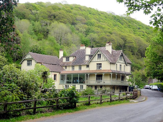
Hunters Inn, nr Martinhoe, Exmoor
© Copyright Tony Atkin and licensed for reuse under this Creative Commons Licence
I probably registered at 7.30-ish then chatted to Steve Frankl from Frome Running Club, Nik Jagodzinski (met at Flete Coastal Marathon & Devon C2C) and a few other ‘usual suspects’.

I decided to carry 500ml of water with ZipVit electrolyte-carb mix and four ZipVit gels.  Plan was to drink water at every feed station and sip what I was carrying between them.  This way I hoped to shorten the stop at each CP.

Speaking to Nik it sounded as though he was treating this as a training session for his attempt at the UTSW in June.  He wasn’t fooling me though.  I knew he’d be competitive all the way round.


Start was in the field on the RHS of the road
© Copyright Eyre Brasher and licensed for reuse under this Creative Commons Licence
The start was in a field just up the river from the Hunters Inn, with the usual collection EL tents.  Gary gave the race briefing at 8.00 then we were off at 8.20.


Start to CP1 Trentishoe (7k)
This wasn’t a mass start.  Each competitor ‘dibbed in’ as they crossed the start line which registered their ‘dibber’ on the timing system.

We ran out of the field and down a wooded path towards the mouth of the River Heddon.  Rob Burnham (2nd) and Mark Steinle (1st) hit the front by the time we got to the bridge over the River Heddon at (10m AOD).  The trail then took a zig zag path up towards the 130m contour and Peter Rock.  On this first ascent of Peter Rock and High Cliff I I managed a steady jog.

View from Peter Rock back up the Heddon Valley
© Copyright Diane Sambrook and license for reuse under this Creative Commons Licence


Just passing underneath Peter Rock and in 4th place behing Reece Ingram

We were now heading south west with Rob and Mark already stretching out a 30 sec lead as we continued to climb up to 240m.  I ran with Reece Ingram (3rd) along the Tarka Trail past Trentishoe.  The path clung to the edge of the rocky cliffs for as long as it could, before cutting inland at North Cleave and heading up towards Holdstone Down.

View west along the north Devon coast
© Copyright 
Phillip Halling and licensed
 for reuse under this Creative Commons Licence
View along the Coastal Path towards Holdstone Down
© Copyright Phillip Halling and licensed
 for reuse under this Creative Commons Licence

The views from the trail were stunning and it’s a pity I couldn't hang around to appreciate them.  I’ll take a Go Pro camera next time!  There was a sharp left turn on Holdstone Down, which took me up to the cain (349m AOD).  From here I had a clear view of CP1 50m below us, next to the main road to Coombe Martin.  At this point I was running on my own as I think Reece had taken a wrong turn.

A path up to Holdstone Down, just west of the EL route
© Copyright Sarah Charlesworth and licensed
 for reuse under this Creative Commons Licence

Cain on top of Holdstone Down
© Copyright Sarah Charlesworth and licensed
 for reuse under this Creative Commons Licence
I reached CP1 (7k)  in 43:58min and 3rd place.  4min behind Mark and 3min behind Rob.


Section stats:  7k in 43:58min at 6:16min/km


CP1 Trentishoe Down (7k) to CP2 Woody Bay (16.5k)
I now started a 3k run downhill to The Hunters Inn.  This was really exhilarating, a bit crazy at times, but fun.  The heathland of Trentishoe Down at 300m turned into a wood with lots of exposed roots (yikes!) and a very steep path.  At 150m the path levelled off and we followed ‘Ladies Mile’ which was flaked by beech trees for about 1k - very pretty.

Dropping another 50m we followed the valley bottom all the way to Heddon Mouth Wood and The Hunters Inn.  As Reece had taken a wrong turn I was in 3rd place.  I glanced at my watch as I past the Hunters Inn - 11k in 1:02hr  Not bad considering the ascent 390m


The path up and out of the Heddon Valley (started at 10m AOD) was wide, well defined and not too rocky.  Unlike the South West Coast Path it followed the contours into Hill Brook and then up round to The Beacon (Roman Fort) at 240m.  The path along the top of the cliffs provided fairly easy running as it winded its way past Martinhoe and into Woody Bay and CP2.

Hill Brook and the higher and lower paths leading up to The Beacon
© Copyright Tony Atkin and licensed for reuse under this Creative Commons Licence


Path through Woody Bay
© Copyright Derek Harper and licensed for reuse under this Creative Commons Licence

The path came out of the wood on the coast road, so the last 0.5k to CP2 was on tarmac.  I arrived at CP2 still running on my own in 1:29:09 and 3rd position.  8min behind Mark and 5min behind Rob.


Section stats: 9.5k to CP2 in 45:11min at 4:47min/km.  Overall 16.5k in 1:29:09hrs at 5:26min/km.


CP2 Woody Bay (16.5k) to CP3 Hillsford Bridge (27.5k)
The route from CP2 (140m AOD) followed the coast road through Woody Bay (frighteningly steep drop on my left!!) for 1k then branched right into Bonhill Wood and then south into a small quiet valley - Caffyns Heaton Wood and Six Acre Wood were very pretty.

Heading out of Woody Bay the path climbed slowly out of the woods and into heathland before zig-zagging up to the summit of South Cleave (270m) -  lovely view of The Valley of Rocks.  I also saw a runner behind me, probably Chris Gilbert (5th) and the first one since loosing sight of Reece at 5k.

During the ascent of South Cleave I took the opportunity of ‘chewing’ on a ZipVit gel.  It was quite chilly at the top and with a slight mist in the air I thought it would have been a good idea to pack some thin gloves.  


View of Lynton from the path off South Cleave
© Copyright Graham Horn and licensed for reuse under this Creative Commons Licence


After another 1k and a 100m descent to the edge of Lynton the route followed minor roads into the centre of the town.  At a small junction (100m AOD) the route turned right and up a very steep hill and onto a tarmac footpath that followed the Lyn Valley towards Lynbridge.  Along this path I didn’t see an EL sign for what seemed like ages and started to question whether I was following the correct route.


Bridge over the River Lyn on the outskirts of Lynton
© Copyright Roger Gittins and licensed for reuse under this Creative Commons Licence

Thankfully at Lyn Bridge (100m AOD) I caught sight of an EL sign.  Still running on my own and in 3rd place I followed the path through the woods, up  some steep zig-zags, onto the Two Moors Way and into some fairly cold wind.


Path up to Summer House Hill from Lyn Bridge
© Copyright Janine Forbes and licensed for reuse under this Creative Commons Licence

At  260m and on an exposed path that followed the East Lyn River valley I felt a bit of rain and again my hands felt cold.


View up the East Lyn River Valley from the footpath at 260m AOD
© Copyright Janine Forbes and licensed for reuse under this Creative Commons Licence

There was an exciting downhill zig-zag on the way to Myrtleberry Cleave.  I remember flying past a couple of walkers, one of them made an exclamation that made me think I’d startled them a bit.


Path round East Lyn Hill
© Copyright Derek Harper and licensed for reuse under this Creative Commons Licence

After rounding the East Lyn hill at 280m I headed south along a path just above the A39 and then descended about 100m through woods to CP3 at Hillsford Bridge.  I’d reached CP3 in 2:30hrs still in 3rd place, just.

Route down from East Lyn Hill to CP3
© Copyright Ruth Sharville and licensed
 for reuse under this Creative Commons Licence
CP3 was just over Hillsford Bridge on the LHS
© Copyright Barbara Cook and licensed
 for reuse under this Creative Commons Licence


Section stats:  11k to CP2 in 1:01:19hrs at 5:36min/km.  Overall 27.5k in 2:30:28 at 5:31min/km.


CP3 Hillsford Bridge (27.5k) to CP4 Woody Bay (39.1k) 
I started this section just ahead of Chris Gilbert, but my feet were beginning to hurt and I found myself trying to run on anything soft. 

Note about the shoes I was wearing.  The Roclite 285’s are lite trail shoes with only a 3mm footbed.  I think a 3mm wasn’t enough for me in this terrain, so next time I’ll add a 6mm footbed to make a total of 9mm.


I ran 1k gradually downhill to Watersmeet and the very picturesque East Lyn River valley.  There were a few walkers and tourists about, but the mist and threat of rain had probably deterred most people from venturing out. 


Bridge over River Lyn at Watersmeet
© Copyright Ruth Sharville and licensed
 for reuse under this Creative Commons Licence

Another 0.5k down the Lyn Valley and at about 100m AOD I turned right up a wide, grassy and steep gully between Wind Hill and South Hill Common.  Chris and then Reece, who’d run an extra 2k, passed me half way up the valley side as we slowly climbed up to the A39 (250m AOD) and towards the summit of Butter Hill.  I chewed on another ZipVit gel during this ascent.


Just to the north of the A39 we picked up the South West Coast Path and headed west down towards Lynmouth.  The view from the path was stunning.  Wwith a very steep drop down to Lynmouth Bay,  I could see Forland Point to the west, the South Wales coast to the north and Ilfracombe to the east.  Not enough time to enjoy it though.


Route down from Butter Hill
© Copyright Graham Horn and licensed
 for reuse under this Creative Commons Licence
View towards Forland Point from the path down to Lynmouth
© Copyright Phillip Halling and licensed
 for reuse under this Creative Commons Licence
The drop in elevation was about 250m over 2k and with the huge drop down to the Bay never far away on my right the run down to Lynmouth was fast, challenging and exhilarating. I managed to pass Chris and catch Reece, although I think I paid for it when I got to the bottom.


As the three of us ran through Lynmouth, over the river and to the footpath up to Hollerday Hill my feet really started to complain - without enough padding in my shoes I felt every sharp stone.  I was also feeling fairly exhausted and couldn’t jog up Hollerday Hill as I had Peter Rock 3hrs earlier.  Instead I walked the majority of the 120m ascent.


Path into Lynmouth on the east of the River Lyn
© Copyright Diane Sambrook and licensed
 for reuse under this Creative Commons Licence
Route along the seafront to the east of the car park
© Copyright Roger Gittins
 and licensed
 for reuse under this Creative Commons Licence


I should have eaten more earlier.  I’d had a gel at 1:30hrs, another at 3:00hrs and had been sipping on 500ml of ZipVit carb-electrolyte mix.  Judging by my sudden lack of energy this probably wasn’t enough.  On previous races I’d had 1 gel every hour and refilled my hydration pack at 20k and 30k.

Path to the Valley of Rocks
© Copyright Phillip Halling and licensed
 for reuse under this Creative Commons Licence
Path to the Valley of Rocks
© Copyright Derek Voller and licensed
 for reuse under this Creative Commons Licence
At 120m AOD the trail joined a tarmac path that followed the steep coastline round to the Valley of Rocks.  I couldn’t see Chris and Reece, which affected my motivation.  It was just another indication I was slowing up.  The tarmac was also hard, so every stride seemed to hurt and I was now seriously considering pulling out at the Marathon finish.


In fact, in terms of how I felt physically and mentally the next four miles were probably the worst of the day.  If there was a period where the wheels started to fall off this was it.


However, the scenery was still breathtaking as I ran, or should I say plodded west.  The footpath seemed to cling to the cliffside for about 1k before moving inland at The Valley of Rocks.  There were also quite a few people out and about which surprised me, but I suppose it was about midday. 


Valley of Rocks
© Copyright Graham Horn and licensed
 for reuse under this Creative Commons Licence

After leaving the VotR and passing Lee Abbey I rejoined the trail through Six Acre Wood and the mainly wooded section to Woody Bay and CP4.  Along the last 1k tarmac length I was passed by Christopher Ashford (4th).


Road to CP4 in Woody Bay
© Copyright Derek Harper and licensed
 for reuse under this Creative Commons Licence


I reached CP4 in 3:42:33 and 6th place.  Happy to stop and rest my feet I had three cups of water and started chewing on another ZipVit gel.


Section stats: 11.6k to CP3 in 1:12:05hrs at 6:15min/km.  Overall 39.1k in 3:42:33hrs at 5:43min/km


CP4 Woody Bay (39.1k, 140m AOD) to CP5 Trentishoe Down (50.5k, 300m)
The trail back to the Heddon Valley took a lower route along the cliffs.  Leaving CP4 I followed the trail through woods down to Martinhoe Manor and then up slightly (50m) towards West Woodybay Woods.

Path between Woodybay Woods and the Heddon Valley
© Copyright Tony Atkin and licensed
 for reuse under this Creative Commons Licence
Waterfall on path between Woodybay Woods and the Heddon Valley
© Copyright Phillip Halling and licensed
 for reuse under this Creative Commons Licence
This part of the run was the return leg of the 1/2 marathon, so was quite busy.  I lost count of the number of runners that went past me.  Coming out of the woods I ran with a bunch of 1/2 marathon runners along the Tarka Trail, the lower of the  two north coast trails.  The path was rocky, which didn’t help the soles of my feet and climbed slowly from 150m to 200m AOD.

Path to the Heddon Valley
© Copyright Derek Harper and licensed
 for reuse under this Creative Commons Licence
Typical coastline
© Copyright Derek Harper and licensed
 for reuse under this Creative Commons Licence
At the mouth of the Heddon Valley the path dropped about 200m down to the river over about a kilometer.  Again the path was rocky which made this section quite unpleasant, so I decided to stop at the Ultra turn, 500m from the marathon finish and ‘take stock’ of my situation.  My watch read 4:16:28.

Path down into the Heddon Valley
© Copyright Dave Coker and licensed
 for reuse under this Creative Commons Licence
I sat down on the side of the trail, took off my shoes and inspected my feet.  They both hurt, but there was no obvious damage.  Had there been I might have pulled out there and then, but instead I sat down for 5 minutes, refilled my hydration pack from the water canisters on the bridge, put my shoes back on and generally prepared myself to tackle the final 10k.  I also noticed a little EL sign - ‘never, never, never give up’.  Mmmm I should try and finish.

Marathon - Ultra split at the bridge over the River Heddon
© Copyright Phillip Halling and licensed
 for reuse under this Creative Commons Licence
This short rest and ‘medical’ check helped to calm me down and definitely helped me finish the race.  The pace around the final 10k wasn’t anywhere near what it was earlier, but I got round and that’s what was important.  In fact really important, considering what I’ve got coming up in the summer - Celtman Tri, X-Man Tri, Norseman Tri and the Devon C2C.


After the busy section from Woody Bay to the Ultra turn I was back to running on my own, but in what position?  As I wasn’t sure who’d passed me earlier, I had no idea what position I was in.


View of Peter Rock and High Cliff
© Copyright Peter Atkin and license for reuse under this Creative Commons Licence

This time round I walked most of the 150m ascent up to Peter Rock, but then was able to run as the trail turned west and headed off towards Trentishoe.  I felt cold running along the exposed 230m high path past Trentishoe and should've put on my windproof jacket and gloves, but I’d spotted another runner a few minutes behind me, so pressed on while chewing my last ZipVit gel.


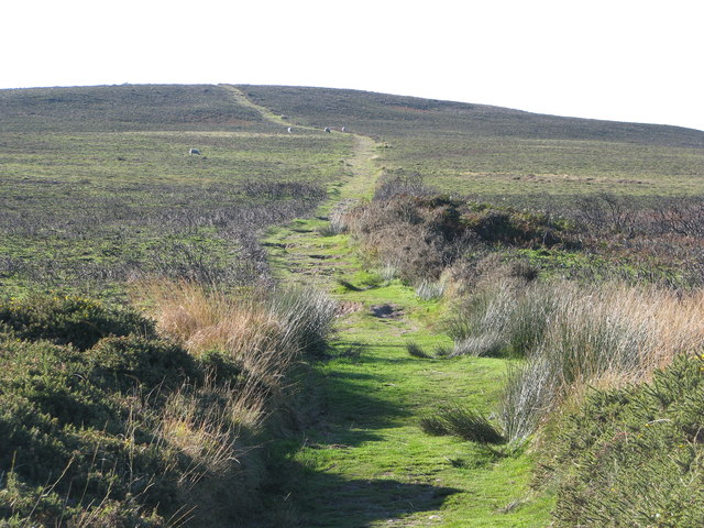
On the path towards High Cliff
Running along High Cliff towards Trentishoe
Knowing the route from earlier I was able to set myself small goals and ticking these off helped get me up to Holdstone Down and stay a few minutes of the runner behind me.

On the descent to CP5 I passed a 10k runner, who must’ve walked the entire route to be this far back!  I reached CP5 in 5:06:26 and 6th place, although I didn’t know it at the time.    Ben greeted me at CP5 and asked how I was.  I can only remember saying ‘cold’


Section Stats: 11.4k in 1:23:53hrs at 7.24min/km.  Overall 50.5k in 5:06:26 at 6:06min/km


CP5 Trentishoe Down (50.5k, 300m) to Finish (54.9k, 20m)
On leaving CP5 I glanced back and saw another runner just coming off the summit of Holdstone Down.  Not wanting to give up another place I tried to ‘gas it’ down the 200m descent to Ladies Mile, but didn’t have much left.  With tired legs and faltering concentration it was difficult to navigate a fast descent through rocks and exposed tree roots.  On a couple of occasions I nearly had a spectacular spill, but just managed to stay on my feet.


View off Trentishoe Down
© Copyright Martin Bodman and license for reuse under this Creative Commons Licence

I pushed it along Ladies Mile and ‘threw’ myself down the final 50m descent, again lucky to stay on my feet, to the valley bottom and the final 2k to the finish.


I didn’t glance back, but was sure I could hear footsteps not too far behind.  Again I forced myself to keep a good pace along the slow descent and tried to run on anything that looked soft.

Road back to The Hunters Inn
© Copyright Basher Eyre and license for reuse under this Creative Commons Licence


On the road to the Hunters Inn I’m sure I heard feet behind me, so picked up the pace again.  I was probably running 4:30min/km at this point, which was very difficult and required everything  I had left.


Passing the Hunters Inn, rounding the corner into the event field and the final 100m to the finish I allowed myself to glance back, but couldn’t see anyone!  My mind had been playing tricks on me?


I reached the finish in 5:29:17 and 6th place.  Really happy with that.


Section Stats: 4.4k from CP5 in 22:51hrs at 5.13min/km.  Overall 54.9k in 5:29:17 at 6:02min/km


My Suunto watch showed the following summary after the race - Suunto Movescount.  54k covered, 2082m of ascent, Av HR of 151 and 4226 Kcals burned


Stats from Suunto Movescount


The results from the top 14 of the EL Ultra

Ultra results - image provided courtesy of Endurance Life


Post Race
I was greeted by James Barker and the race medic at the finish.  I thanked James for another great event and told him had it not been for the ‘never never never give up’ signs I would’ve pulled out at 42k.


In the finishers tent I bumped into Steve Frankl (Frome Running Club), who’d just finished the marathon in 4:48.  Ten minutes later Nik Jagodzinski crossed the line.


To cool my muscles down a bit I tried sitting in the River Heddon, but it was too chuffin cold!  After the Devon Ultra I stood in the sea for 5 mins and I’m sure it really helped.  I then stood and watched the presentations with Nik.  Mark Steinle won the Ultra in 4:34 and set a new course record.  Mark was an Olympic marathon runner (Sydney Olympics) and has had some impressive performances - Marks iaaf.org stats


Post race food was the usual ZipVit protein bar and 500ml of ZipVit recovery drink.  This stuff is supposed to taste of chocolate, but doesn’t.  

Would have liked to stay for the lectures, but with an U18 rugby team to assemble for Sunday I had to get home.  I walked back up Kings Lane to the car park at Mannacott with Steve Frankl and made my way home.


Exmoor is a beautiful place and the marathon/ultra routes take you through some of the best bits.  I'll have to come back next year and try to finish in less than 5hrs ;-)

Race Kit
HH base layer - was a bit chilly
Tech T-shirt
Running cap - keeps sweat from eyes
Ronhill shorts
Inov-8 Mudsoc
Roclite 285 trail shoes with a 3mm footbed - too thin, needed at least 6mm.
Salamon s-Lab hydration pack
4 ZipVit gels
500ml of water with ZipVit carb-electrolyte mix
2 laminated route maps
Mandatory kit

Monday 9 April 2012

Edale Skyline Fell Race 2012


View of southern skyline from Mam Tor - picture courtesy of Colin Jacobs

Intro
This is a fantastic race, in the right weather.  Luckily on March 25th 2012 it was perfect - clear sky, dry and pleasantly warm.
It’s a category AL fell race, so previous experience of longer distance trail running with appreciable vertical gain is essential.  It’s also a race dominated by fell runners from the peak district.  I must have been one of only an handful of ‘soft southerners’.
The first half of the route is relatively straight forward.  Apart from a short scramble up to the first checkpoint the paths are well defined and not too technical.  In fact two thirds of the southern ‘skyline’ is on a tourist path.
The race really starts in the second half where navigation, quick thinking and dexterity play a big part.  The paths are difficult to find, very boggy or rocky and the gradient often severe.  Put all this together and after 20 miles your legs, core muscles and concentration are ........ well fairly worn out.
Background
A lingering hamstring and calf strain meant I hadn’t been for a proper run since the Devon Ultra on 16th Feb.  A few 8k or 10k runs with the dogs, but I kept pulling up short or going very slowly.  I did managed a 12k on the Friday afternoon before the race, without re-occurrence of the calf strain, but it felt tight.
Would the body stay together? I decided to give it a go, get round and don’t push too hard.
The race requires navigation if visibility is poor, so I spent a reasonable amount of time in front of the OS map.  I plotted the route, marked on check points, water points and tried and memorize as many route markers/characteristics as possible.
I also read through the Fell Running Association (FRA) forums for current and past Edale Skyline issues and recommendations.
Mandatory kit included:
  • Compass.  Up on Brown Knoll and Kinder there are no big landmarks and with visibility possibly down to 50m navigation could be a real problem.
  • Map - I took two small laminated OS maps
  • whistle
  • food and water
  • hat and gloves
  • windproof top and trousers

Day before prep
Spent the morning in the garden pottering about.  Started to eat the usual mix of low GI carbs from about lunchtime and drank enough to be properly hydrated by 8pm - pee was completely clear!  Just thought you should know.
I decided to stay in Somerset on Saturday evening to watch Liz sing in the White Horse Opera, so packed all my kit and food for breakfast in the car ready for an early start the next day. 

Day of the race
Woke up at 4.30, faffed about for 30mins and left just before 5am.
I had breakfast in the car on the way to Edale.
  • Low GI carbs for early breakfast - 5.30am
  • Porridge at 7am
  • 1ltr of water with carb/electrolyte mix
  • a small coffee to keep me awake
I drove to Edale, via the M5, M6, Stoke, Leek and arrived at 8.30-ish.  Parking was in the Edale station overflow car park.  Registration was in the village hall adjacent to the station - 3 mins walk away from the car park.


View across the Peak District at about 8.30am - picture courtesy of Colin Jacobs

Registration hadn’t formally opened when I arrived and I was one of only a handful of competitors in the hall, but at least I could use the toilet without queuing.  I could also spend time examining the big route map hung up in the village hall.  It was a Edale Skyline map sold by Lakes Runners (http://www.lakesrunner.com) and available via their website for £12, I think.
I then assembled my race kit, got it checked and ‘approved’ before registering and collecting my race number.  I also made my way through 500ml of water (with carb electrolyte mix) and a banana.

All suited and booted I stood around outside registration in the morning sun, soaking up the atmosphere and  talking to a few past and present runners - “Race starts after Mam Tor”, “Route up to Brown Knoll is difficult, but easier today, due to recent dry weather”, “Route past Kinder Scout is difficult”.  
Of course non of this meant much to me, as I hadn’t seen any of these places.  However it was good to get advise and hopefully stuff would start to fall into place as the race progressed.
Start line before everyone arrived - picture courtesy of Colin Jacobs
Clean, refreshed and itching to get started - picture courtesy of Colin Jacobs

Just before we set off at 10 for the walk up to the start some marshals handed out bags of jelly Babies.  At 70cal a bag they’d come in handy as emergency rations.  The start was in a field (Heardsmans Plantation) just east of Grindsbrook Booth. 

I met Colin at the start.  I was suppose to meet him an hour earlier for a flask of coffee, but somehow we missed each other.  He gave me a few last minute fell race tips:
  • Get to the front to avoid the bottleneck at the stile
  • Don’t be afraid to use elbows
  • Don’t be fooled by runners suddenly slowing up.  They want you to pass, then take a short cut.
Race
We hardly heard the starters gun.  I quickly got into the top 30-ish as we ran up the field towards the stile.

Start line in Heardsmans Plantation, Edale - picture and movie courtesy of Colin Jacobs

We were straight into a steep ascent, which started as stone steps then path, gravel path and finally just rocks.  The final ascent up to Ringing Roger was more like a Grade 1 scramble than a trail run.  CP1 was perched on top of Ringing Roger at 550m.

CP1 - Ringing Roger.  Picture courtesy of Colin Jacobs

CP1 Ringing Roger to CP2 Win Hill
The next section to Win Hill was fast.  The path followed the 550m contour for a bit, but was reasonably technical - needed nimble feet and quick thinking.  This suited me, so I managed to pass a few runners.
At Crookstone Out Moor the route turned southeast and went downhill towards Woodlands Valley.  Down on the gentle slopes adjacent to the woods I ran with a small group in the shade of the trees, then took the racing line from Home Brink to Win Hill.

Looking east towards Win  Hill

  © Copyright Stephen Horncastle and licensed for reuse under this Creative Commons Licence

The final climb up to CP2 at 462m was again a scramble.  I glanced at my watch.  It’d taken me 55min to reach CP2.  I also felt the temperature rising, which worried my a little.  I hoped it wouldn’t get too hot as I was only carrying 500ml and there were only 2 water stops.


CP2 Win Hill to CP3 Hope
From CP2 we were immediately into a sharp and fast descent down to Hope.  The path was rocky at first, but after about 1k it opened up into fields, but was still very steep.

After passing through Twitchill Farm there was a short stretch of tarmac road before we went underneath the railway bridge and onto the minor road down to Hope and the River Noe.
  

Looking down the Twitchill Farm track from the hillsides above the farm.


  © Copyright Andrew Hill and licensed for reuse under thisCreative Commons Licence


At this point I became aware I was running with the 3rd placed lady Laura Gibson from Totley RC.  How did I know this?  Well, nearly every spectator we ran past shouted “well done 3rd lady”, “Go on Totley”.
CP3 was located on the bridge over the River Noe at 170m.  I took a few minutes to have 3 cups of water, some of which i poured over my head - just enough to cool me down.  There were jelly babies on offer, but I thought I’d stick to the ZipVit gels.

CP3 Hope to CP4 Lose Hill
We ran up Edale Road for 1k then turned left just before Townhead Bridge onto a footpath.  This section of the run was going to be difficult - it was a long slog up to Brown Knoll.
The gradient suddenly increased and after a few 100m’s we turned right at Townhead and joined a footpath that would take us up to the summit of Lose Hill at 476m and CP4.
The footpath started in a small sheltered drove before opening up into heathland.  We quickly gained height and got onto a broad ridge that curved west and then north towards Lose Hill.  I surprised myself by running some of this.


Looking south off Lose Hill.  Path followed flat ridge.

  © Copyright Peter Turner and licensed for reuse under thisCreative Commons Licence


Over an hour into the race and I still felt okay.  I kept going over the things I had to do, i.e. controlled breathing, don’t get too worked up, keep the cadence high, concentrate on what’s just ahead and don’t worry about what’s off in the distance.
CP4 (476m) was right on top of Lose Hill, which was reasonably broad and flat compared to the previous CP’s.  A young lad was counting us over the top and told me I was 70th, not sure how accurate he was.

CP4 Lose Hill to CP5 Mam Tor
The path off Lose Hill was rutted and on a gradual gradient down the ridge, so I turned on the gas a bit and passed a few runners.  At a small col (Back Tor at 391m) we hopped over a fence and ran along Barker Bank, the southern slope of Lose Hill.


Running off Lose Hill, just ahead of Laura Gibson.  Picture courtesy of Edale Skyline

The path passed Hollins Cross and then started the long steady climb up to Mam Tor and CP5.  The running surface changed at this point from grass to large stone slabs - massive things.  How they were transported up there I’ll never know.
The number of spectators suddenly seemed to increased and Laura (who I was still running with) was clapped and encouraged all the way up the 130m climb.  
The summit of Mam Tor (517m) was covered in spectators and Paragliders preparing their kit for flight.  There were also a few flying around just off the southern flank of Mam Tor.
CP5 (455m) was 60m down the other side of Mam Tor and on the other side of the road.  I met Colin, who told me I was 60th!  Not bad for a soft southerner.


I took a couple of minutes to have 3 cups of water, a little of which I poured over my head to cool me off.
CP5 Mam Tor to CP6 Lords Seat
The path along Rushup Edge andup to Lords Seat at 540m was rocky, but well defined.  The gradient then flattened as we got to the cain at 488m and ran towards CP6.  As this was the last good bit of path before the Brown Knoll bog I could concentrate on chewing my way through a ZipVit gel and catching Laura and a couple of Dark Peak Fell Runners (DPFR) who’d left CP5 just ahead of me.

The highest point in the distance is Lord's Seat.

  © Copyright Graham Hogg and licensed for reuse under this Creative Commons Licence

CP6 Lords Seat to CP7 Brown Knoll
I was told this would be where the race really started.  I’m not sure about the racing, but the navigation certainly got tougher.  Without a defined path we had to run 3k across peat bogs and up the remaining 90m to Brown Knoll.


This post indicates where the path up to Brown Knoll departs from the bridleway. This flat ridge is on the watershed of Great Britain - to the left streams flow ultimately into the Mersey, to the right the Humber.

  © Copyright Dave Dunford and licensed for reuse under this Creative Commons Licence

The ground was very undulating, peaty, rocky in places and peppered with small bogs.  Thankfully it hadn’t rained recently, so there wasn’t too much standing water, but I still found it difficult and quite exhausting.  Not sure how I would have faired If it had been misty and wetter under foot.
The DPFR lads know the route very well.  It’s their race.  So, it’s good to follow their lead, especially through tricky sections like this one.  Rather foolishly I ran ahead of the DPFR  bunch for a short while and very quickly wished I hadn’t.  I fell into a bog.  Left side, shoulder and arm covered in peat bog muck, middle finger bent back and left feeling rather silly.
After brushing off the worst, inspecting my finger and deciding it wasn’t broken I carried on running, but rather sheepishly at the back of the DPFR bunch.  Don’t get over confident in unfamiliar terrain!
Running on the heals of Laura and DPFR boys and nursing a throbbing finger we reached CP7 on top of Brown Knoll (569m).

CP7 Brown Knoll to CP8 Grindslow Knoll
A short marked section lead us off the top, down towards a fence and a new stone slab path.  By this time I’d gathered my composure a little and was thinking of overtaking the DPFR lads, but I couldn't.  The stone path was narrow and the ground either side very uneven and peaty.  I had to be patient.

Within 1k we’d reached the top of Jacobs Ladder (530m) and the short climb up to Swine’s Back (600m).  The next short section from Swine’s Back to Noe Stool broadly followed the 600m contour and formed the Edale Head.  The view down the valley was fantastic, but sadly I didn't see enough of it as I had to concentrate on the path ahead of me.


View south from just below Swines Back

  © Copyright Colin Park and licensed for reuse under thisCreative Commons Licence


I decided to follow one of the older DPFR lads along a short cut to gain an advantage.  It followed a sheep path just underneath Swines Back and joined the main path half way to Noe Stool.  Even though the route was shorter the terrain was rubbish.  By the time I’d dragged myself through the bracken I ended up back on the main path just behind laura!  No advantage then.
Climbing the small Tor at Noe Stool we entered the section from Edale Head to Crowden Tower, which again followed the 600m-ish contour.  This area was one big peat bog.  The terrain to our right was a steep slope down into Edale and to our left a wide flat plain known as Kinder Scout.  Again, had it been misty and wet I would have been knee deep in peat and struggling to find my way.

View of Grindslow Knoll from near Mam Tor - picture courtesy of Colin Jacobs

I followed Laura and the another runner along ‘the racing line’ across Kinder Scout.  We stuck to as many grassy knolls as we could but invariably ended up climbing in and out of 2m deep dry peat beds.  The main path, which was off to the right, followed the curved edge of Edale Head.
Improving your race position in this terrain is as much about picking the right route as it is about speed.  Entering a small gully at the end of this section I spotted a rocky short cut, quickly took it and leaped ahead of laura.  
Climbing out of the gully we started on the 2k section to Grindslow Knoll, CP8 and the penultimate section of the race.  I was now finding it hard and was looking forward to the finish.  

The gradient was relatively flat (580-590m) and the path improved, slightly.  Instead of open peat bog we followed a visible path worn into the peat with the occasional rock clusters.  I passed another Totley runner on the short 20m ascent to Grindslow Knoll and CP8 at 600m.

CP8 Grindslow Knoll to CP9 Ringing Roger
The path along this section was well defined, but very rocky.  I decided to turn on the gas a bit, put a bit of distance between me and Totley runners and try to overtake a few flagging runners.
I quickly overtook a few runners, but then stopped as I climbed out of the small gully at the head of Grindsbrook Clough.  The path turned right, but I remembered seeing a ‘racing line’ on the map at reception.  I couldn’t see anything obvious, so not wanting to hang about took the main path.


Path on top of Grindsbrook Clough from Grindslow Knoll.

  © Copyright steven ruffles and licensed for reuse under this Creative Commons Licence


I overtook another runner on a rocky downhill section and then after about 1k noticed Laura and the other Totley runner I’d passed at CP 8 100m off to my left.  They’d found and taken the racing line.  I arrived at the intersection of the two paths 10 paces behind them!
Sometimes it’s better to hold back and follow other runners, especially when you don’t know the route well enough (didn't I mention that earlier?).  Definitely got to recce the course before doing it next year.
The path was still very rocky and undulating, even though it followed the 590m contour.  I was getting very tired by this stage.  Three hours of running, navigation, concentration, balance and now self imposed pressure of racing was making me feel...... well, knackered.  I should have taken another Gel on Kinder to give me a boost.
That said I still managed to pass one of the Totley runners after a few 100m’s and pass Laura on a tricky rocky downhill section.  I stayed ahead of her and passed other runners on the way to Ringing Roger and CP9.  I climbed up to CP9 (550m) with two DPFR lads Graham Walton (898) and Austin Frost (647).

CP9 Ringing Roger to Finish
Finally all downhill, so time to give it everything I had left, which wasn’t much.


Path off Ringing Roger

  © Copyright Phil Champion and licensed for reuse under this Creative Commons Licence

We had to scramble off Ringing Roger, so couldn’t move very fast.  Once on the path I ‘disengaged’ the brain and just went for it.  Well that’s what it felt like.  Looking at the Accelerate YouTube vid [see link a the end, min 5:50 to 6:10] it doesn’t look like it.
Can’t remember much about the final descent other than it was rocky, felt very technical, frantic and it hurt.  My legs were aching, my core muscles overworked and my brain exhausted from the constant concentration on where to put my feet.

Approaching the finish line - pictures courtesy of Colin Jacobs

Not sure how I got down without tripping up, but I did, passing a few runners (Austin, 647) in the process and left Laura behind.  Graham Walton (898) though disappeared ahead of me.  I thought I was quick on the downhills, but Graham was lightning quick.  He finished just over 1min ahead of me in 3:27:59.
At the bottom of the steep rocky path leading off The Nab we entered Heardsmans Plantation and the finish field.  I pushed all the way to the finish line as I wasn’t sure if anyone was behind me.


I finished in 3:29:12, which was 40mins behind the winner Carl Bell (2:48:51), but wow, what a race and huge sense of achievement. 
Colin and Ruth were waiting to welcome me back, which was nice.  I sat down with them next to the finish and could have laid down on the grass in the warm sun for the rest of the afternoon, but I had to get home.  I had a banana and lots of water with a couple of Nuun tablets to get some salt back into my system.


Overall a fantastic race, some very technical trails, a beautiful route, fantastic views, unseasonably clear and warm weather and a decent performance.  All in all a great day out.

Here's a link to the Suunto T3 data - Heart rate and speed throughout the 3:29hrs.  Suunto Movescount - Edale Skyline T3 HR and speed data

Kit and stuff used, in no particular order:

  • 500ml water with ZipVit carb-electrolyte mix
  • 1 ZipVit gel
  • Salomon advanced skin s-lab vest-hydration pack
  • Inov-8 Roclite 285 trail shoes
  • Inov-8 mudsoc
  • 2XU calf compression socks
  • Ronhill shorts
  • Tech t-ishirt

Below is a link to the Edale Skyline 2012 YouTube video produced by Accelerate UK, Sheffield.